
$ 50,000
622 N HAMMONDS FERRY RD Linthicum Heights, MD 21090
Schedule a Tour
REQUEST A TOUR If you would like to see this home without being there in person, select the "Virtual Tour" option and your agent will contact you to discuss available opportunities.
In-PersonVirtual Tour


REQUEST A TOUR If you would like to see this home without being there in person, select the "Virtual Tour" option and your agent will contact you to discuss available opportunities.
In-PersonVirtual Tour
$ 50,000
Est. payment /mo
Pending
622 N HAMMONDS FERRY RD Linthicum Heights, MD 21090
1,936 SqFt
UPDATED:
10/17/2024 05:37 PM
Key Details
Property Type Commercial
Sub Type Industrial
Listing Status Pending
Purchase Type For Sale
Square Footage 1,936 sqft
Price per Sqft $25
Subdivision Community Farms
MLS Listing ID MDAA2095584
Originating Board BRIGHT
Year Built 1960
Annual Tax Amount $3,292
Tax Year 2024
Lot Size 10,019 Sqft
Acres 0.23
Property Description
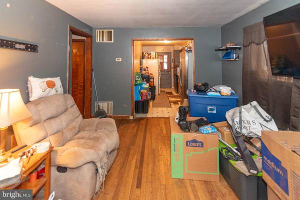
List price is Opening Bid At The Online Only Auction Sale. An online auction is to be conducted on the Auctioneers website. Bidding begins Friday, October 11th & ends Wednesday, October 16th, 2024 at 1:00 pm. Multi-Building Commercial/Residential Property, Zoned W-1, on 0.23± acres in the "Community Farms" subdivision of Linthicum Heights, Anne Arundel County. According to SDAT, the property includes a one-story residence with approximately 968± square feet of above-grade living space and a basement. Tenants currently occupy the property. It is believed to include a detached garage building with two bays.
Metes and Bounds Description: ALL that real property lying in the 5th Election District, Anne Arundel County, State of Maryland as described by James D. Hicks, Registered Surveyor, by Survey dated May 5, 1959 and recorded among the Land Records of Anne Arundel County, Maryland on May 26, 1959 in Book 1299, at Page 34, as follows: BEGINNING on the west side of Hammonds Ferry Road (Maryland Route 167) at a point 700.57 feet, more or less, south of the corner formed by the intersection of Nursery Road and Hammond Ferry Road thence binding along Hammond Ferry Road (1) South 23 degrees, 16 minutes, 40 seconds East 53.57 feet, thence westerly along the common boundary line with Lot 14 “Community Farms” per Anne Arundel County Plat Book 15, Page 48 (2) South 87 degrees, 45 minutes, 20 seconds West 209.61 feet, thence (3) North 2 degrees, 14 minutes, 40 seconds West 50 feet, thence (4) North 87 degrees, 45 minutes, 20 seconds East 190.40 feet, to the place of beginning. Containing 0.23 acres of land, more or less, as shown on said Survey. Zoning W1 - Industrial Park District
Metes and Bounds Description: ALL that real property lying in the 5th Election District, Anne Arundel County, State of Maryland as described by James D. Hicks, Registered Surveyor, by Survey dated May 5, 1959 and recorded among the Land Records of Anne Arundel County, Maryland on May 26, 1959 in Book 1299, at Page 34, as follows: BEGINNING on the west side of Hammonds Ferry Road (Maryland Route 167) at a point 700.57 feet, more or less, south of the corner formed by the intersection of Nursery Road and Hammond Ferry Road thence binding along Hammond Ferry Road (1) South 23 degrees, 16 minutes, 40 seconds East 53.57 feet, thence westerly along the common boundary line with Lot 14 “Community Farms” per Anne Arundel County Plat Book 15, Page 48 (2) South 87 degrees, 45 minutes, 20 seconds West 209.61 feet, thence (3) North 2 degrees, 14 minutes, 40 seconds West 50 feet, thence (4) North 87 degrees, 45 minutes, 20 seconds East 190.40 feet, to the place of beginning. Containing 0.23 acres of land, more or less, as shown on said Survey. Zoning W1 - Industrial Park District
Location
State MD
County Anne Arundel
Zoning W1
Interior
Hot Water Other
Heating Other
Cooling Other
Heat Source Other
Exterior
Waterfront N
Water Access N
Accessibility None
Parking Type Driveway
Garage N
Building
Sewer Public Sewer
Water Public
New Construction N
Schools
School District Anne Arundel County Public Schools
Others
Tax ID 020512790109787
Ownership Fee Simple
SqFt Source Assessor
Special Listing Condition Auction

Listed by Jared T Block • Alex Cooper Auctioneers, Inc.
GET MORE INFORMATION
QUICK SEARCH